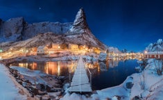
Kulusuk, formerly Kap Dan, is a settlement in the Sermersooq municipality in southeastern Greenland, located on an island of the same name. The settlement population of 267 includes many Danes choosing to live there due to the airport. In the Kalaallisut language, the name of the village means "Chest of a Black Guillemot".
The urbanized area of the settlement is centered around the harbour in the northwestern part of the island, on the shores of the Torsuut Tunoq sound. Industrial utility buildings are also scattered in the vicinity of the airport, to the northwest of the runway.
The island measures 8 km (5.0 mi) from north to south and 11 km (6.8 mi) from west to east. It is hilly throughout, with several distinct mountains dominating the eastern and southern coast. The southernmost point is Cape Naujaangivit, formerly Cape Dan (Danish: Kap Dan, a name previously extended to the settlement and island) under the Isikajia mountain.
The highest point on the island is the summit of Qalorujoorneq, at 676 m (2,217.8 ft) topping a wide mountain massif in the southeast, directly above the airport.


