
説明
まとめ
説明
10日間の冬季写真ツアーで、アイスランドの美しい光や風景を撮影しませんか。氷やオーロラなど、冬ならではの題材にチャレンジします。受賞歴もある写真家がガイドを務めますので、短期間でめきめきと力がつくはずです。
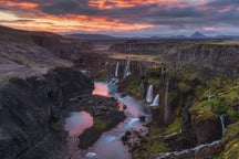
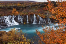
現地での移動にはゆったりとくつろげるバスと悪路も走れる改造ジープを駆使し、おすすめの撮影スポットまでご案内します。スナイフェルスネス半島ではキルキュフェトル山やBúðirの黒い教会などを写します。南海岸ではアイスケーブ、ヨークルスアゥルロゥン氷河湖、ダイヤモンド・ビーチや冬の滝などのテーマに取り組みます。
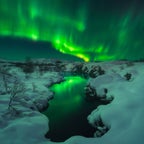
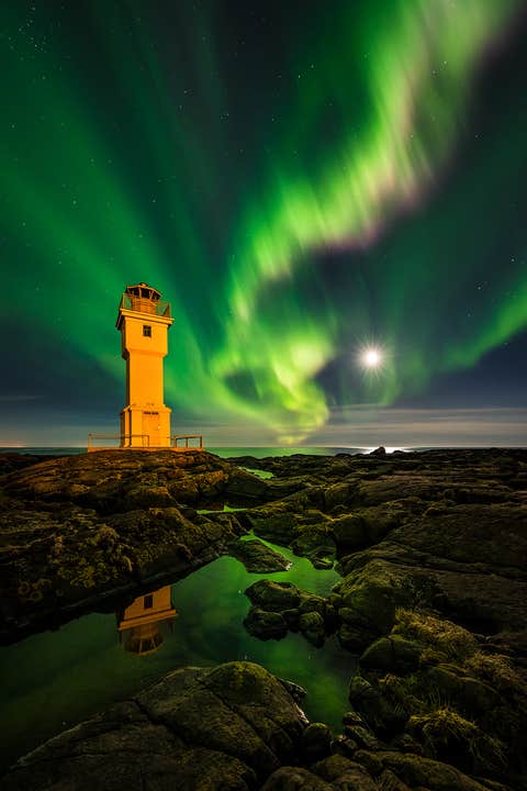
そしてアイスランドといえばオーロラ。北極圏の夜空にゆらめく光のカーテンは一度は見てみたいもの。経験豊富なガイドがオーロラ予報や天候条件を確認し、最高のロケーションで撮影できるよう気を配ります。
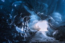
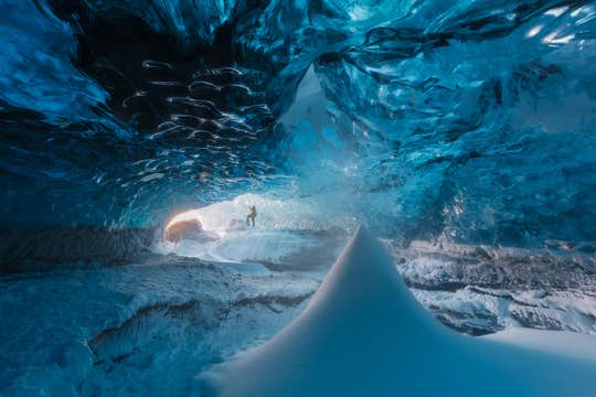
また本ツアーにはアイスケーブ探検も含まれています。いくつもの偶然が重なってできる天然の氷の洞窟は繊細です。安全に撮影をお楽しみいただけるよう、プロのアイスケーブ・ガイドが同行し、装備の貸し出しも行います。洞窟の中はまるで別世界のよう。見たこともない形や質感、光に夢中になることでしょう。
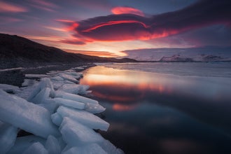
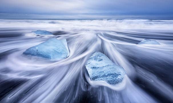
アイスランド観光の王道、ヴァトナヨークトル国立公園も外せません。Breiðmerkurjökull氷河から融け落ちた氷塊が輝くヨークルスアゥルロゥン氷河湖とダイヤモンド・ビーチの撮影時間も、もちろんたっぷり確保してあります。
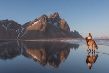
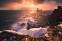
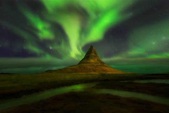
そしてスナイフェルスネス半島は冬が最高です。北極圏のビーチ、奇怪な形に冷え固まった溶岩、アイコニックな形で写真家を魅了してやまないキルキュフェトル山など数々の名所が雪化粧をして皆さまをお待ちしています。
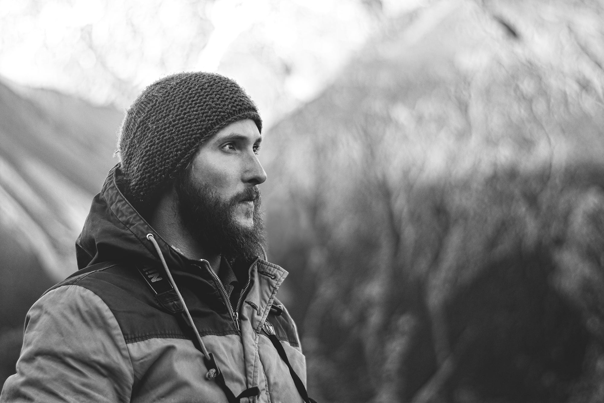
比較的小人数で催行するこの写真ツアーは参加者のニーズに応じて柔軟に対応しますので、初心者からベテランの方まで、幅広くご参加頂けます。ガイドは皆受賞歴のある写真家ですので安心してお申込みください。
愛機とともに冬のアイスランドを巡る10日間の旅、参加人数には限りがありますのでご予約はお早めに。一緒に人生最高の写真を目指しましょう!日付を選択すると予約状況を確認できます。